
Santa Barbara Surf Report & Forecast
Sunday August 2nd, 2026
First Light: 5:08 AM · Full Darkness: 9:01 PM
NOAA Tide Prediction for Santa Barbara
NOAA Buoy Observations
| Station Name | Time | Wave Height | Dominant Period | Direction | Water Temp |
|---|---|---|---|---|---|
| West California (46059) | 08/02 12:20pm | 8.9 ft | 7 sec | 27° | 66 °F |
| Point Reyes (46214) | 08/02 12:26pm | 13.4 ft | 10 sec | 318° | 56.5 °F |
| Monterey (46042) | 08/02 12:20pm | 7.9 ft | 11 sec | 316° | 59.9 °F |
| Point Sur (46239) | 08/02 12:30pm | 8.2 ft | 10 sec | 315° | 58.5 °F |
| Cape San Martin (46028) | 08/02 12:20pm | 8.5 ft | 10 sec | 313° | 55 °F |
| Santa Maria (46011) | 08/02 12:20pm | 7.2 ft | 9 sec | 307° | 59.9 °F |
| Santa Lucia (46259) | 08/02 11:56am | 8.9 ft | 9 sec | 321° | 59.7 °F |
| Harvest Buoy (46218) | 08/02 12:26pm | 7.9 ft | 10 sec | 327° | 67.8 °F |
| West Santa Barbara (46054) | 08/02 12:20pm | 5.2 ft | 9 sec | 290° | 61.2 °F |
| East Santa Barbara (46053) | 08/02 12:20pm | 3.3 ft | 9 sec | 271° | 69.6 °F |
| S. Santa Rosa Island (46069) | 08/02 12:20pm | 6.2 ft | 8 sec | 305° | 65.8 °F |
| San Nicolas Island (46219) | 08/02 12:26pm | 5.9 ft | 8 sec | 305° | 63 °F |
| Santa Monica Basin (46025) | 08/02 12:20pm | 3 ft | 13 sec | 216° | 72.1 °F |
| San Pedro (46222) | 08/02 12:26pm | 2.6 ft | 6 sec | 280° | 75.2 °F |
| Tanner Bank (46047) | 08/02 12:20pm | 4.9 ft | 8 sec | 308° | 66 °F |
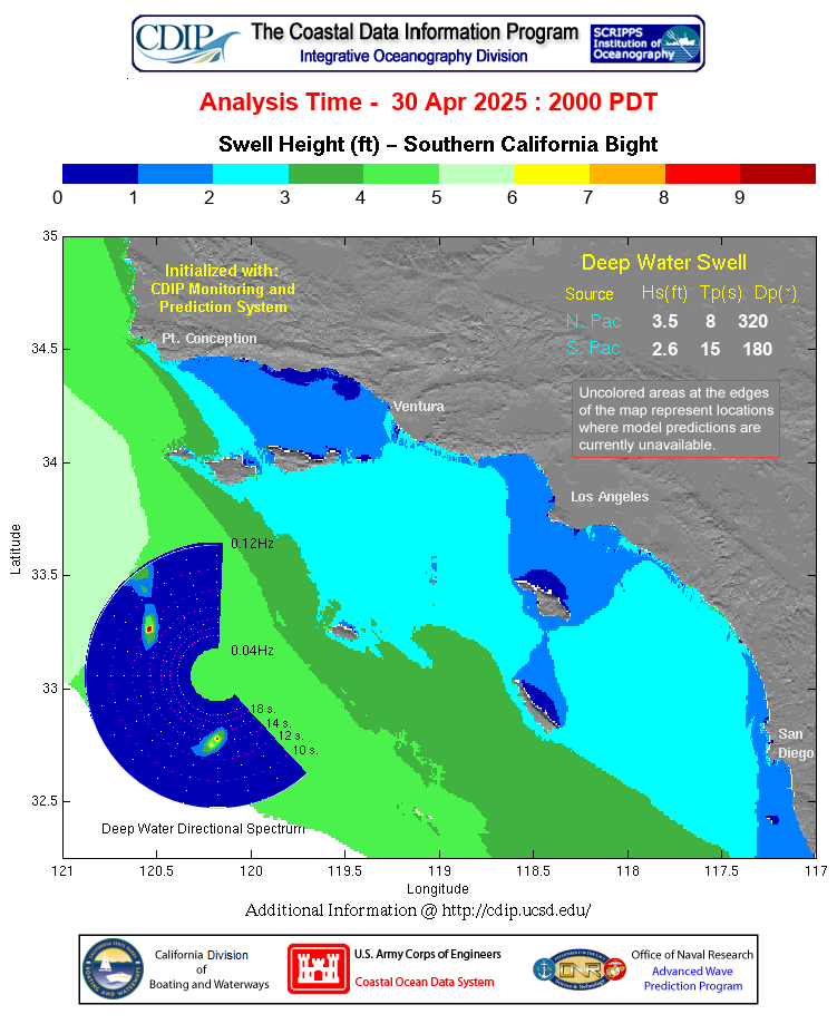
Southern California Swell Model
NOAA Santa Barbara County Southwestern Coast Surf Zone Forecast
Expires:202608022315;;489554
FZUS56 KLOX 020857
SRFLOX

Surf Zone Forecast
National Weather Service Los Angeles/Oxnard
157 AM PDT Sun Aug 2 2026


CAZ349-350-022315-
Santa Barbara County Southwestern Coast-
Santa Barbara County Southeastern Coast-
157 AM PDT Sun Aug 2 2026

...MODERATE RIP CURRENT RISK...

.TODAY...
Rip Current Risk*.............Moderate.
Surf Height...................2 to 4 feet.
Thunderstorm Potential........None expected.
Water Temperature.............Around 70 degrees.
Tides.........................Low 0.3 feet (MLLW) 07:35 AM PDT.
                              High 4.5 feet (MLLW) 02:08 PM PDT.
                              Low 1.9 feet (MLLW) 07:49 PM PDT.
Remarks.......................West swell.

.MONDAY...
Rip Current Risk*.............Low.
Surf Height...................1 to 3 feet.
Thunderstorm Potential........None expected.
Tides.........................High 4.4 feet (MLLW) 01:31 AM PDT.
                              Low 0.8 feet (MLLW) 08:01 AM PDT.
                              High 4.8 feet (MLLW) 02:41 PM PDT.
                              Low 1.8 feet (MLLW) 08:54 PM PDT.
Remarks.......................West swell.


&&

Rip Current Risks:
* Low Risk - Life threatening rip currents are unlikely but still could occur.
* Moderate Risk - Life threatening rip currents are possible.
* High Risk - Life threatening rip currents are likely.

$$
Source: NOAA
East Santa Barbara Channel Coastal Waters Forecast (PZ 650)
Expires:202608030615;;506637
FZUS56 KLOX 021711
CWFLOX

Coastal Waters Forecast for California
National Weather Service Los Angeles/Oxnard CA
1011 AM PDT Sun Aug 2 2026

Point Piedras Blancas to San Mateo Point CA out 60 NM including the
Channel Islands National Marine Sanctuary.


PZZ650-030615-
East Santa Barbara Channel from Pt. Conception to Pt. Mugu CA
including Santa Cruz Island-
1011 AM PDT Sun Aug 2 2026

.TODAY...Light winds, becoming W 10 to 20 kt this afternoon. Seas
2 to 4 ft. Wave Detail: W 3 ft at 9 seconds. Patchy fog this
morning.
.TONIGHT...W wind 10 to 20 kt, becoming 5 to 10 kt after midnight.
Seas 2 to 4 ft. Wave Detail: W 3 ft at 7 seconds. Patchy fog after
midnight.
.MON...W wind 5 to 10 kt, becoming 10 to 20 kt in the afternoon.
Seas 2 to 3 ft. Wave Detail: W 2 ft at 6 seconds and W 3 ft at
9 seconds. Patchy fog in the morning.
.MON NIGHT...W wind 10 to 15 kt, becoming 5 to 10 kt after
midnight. Seas 2 to 4 ft. Wave Detail: W 3 ft at 7 seconds.
.TUE...Light winds, becoming W 5 to 10 kt in the afternoon. Seas
2 to 3 ft. Wave Detail: W 2 ft at 8 seconds. Patchy fog in the
morning.
.TUE NIGHT...W wind 10 to 15 kt, becoming 5 to 10 kt after
midnight. Seas 2 to 3 ft. Wave Detail: W 3 ft at 5 seconds.
.WED...W wind 5 to 10 kt, becoming 10 to 15 kt in the afternoon.
Seas 2 ft. Wave Detail: W 2 ft at 7 seconds.
.WED NIGHT...W wind 10 to 20 kt, becoming 5 to 10 kt after
midnight. Seas 2 to 3 ft. Wave Detail: W 3 ft at 5 seconds.
.THU...Light winds, becoming W 5 to 10 kt in the afternoon. Seas
2 ft. Wave Detail: W 2 ft at 5 seconds.
.THU NIGHT...W wind 10 to 20 kt, becoming 5 to 10 kt after
midnight. Seas 2 to 3 ft. Wave Detail: W 2 ft at 5 seconds.

$$
Source: NOAA
Waters Forecast from Pt. Sal to Santa Cruz Island and Westward 60 NM (PZ 673)
Expires:202608030615;;506635
FZUS56 KLOX 021711
CWFLOX

Coastal Waters Forecast for California
National Weather Service Los Angeles/Oxnard CA
1011 AM PDT Sun Aug 2 2026

Point Piedras Blancas to San Mateo Point CA out 60 NM including the
Channel Islands National Marine Sanctuary.


PZZ673-030615-
Waters from Pt. Sal to Santa Cruz Island CA and westward 60 nm
including San Miguel and Santa Rosa Islands-
1011 AM PDT Sun Aug 2 2026

...SMALL CRAFT ADVISORY IN EFFECT THROUGH LATE TONIGHT...

.TODAY...NW wind 15 to 25 kt, becoming 20 to 25 kt this afternoon.
Seas 6 to 8 ft. Wave Detail: NW 8 ft at 9 seconds and S 2 ft at
11 seconds. Patchy fog this morning.
.TONIGHT...NW wind 20 to 25 kt, becoming 15 to 20 kt after
midnight. Seas 6 to 8 ft. Wave Detail: NW 7 ft at 10 seconds and S
2 ft at 11 seconds. Patchy fog.
.MON...NW wind 10 to 20 kt. Seas 6 to 8 ft. Wave Detail: NW 7 ft at
10 seconds and S 2 ft at 12 seconds. Patchy fog in the morning.
.MON NIGHT...NW wind 10 to 20 kt. Seas 6 to 8 ft. Wave Detail: NW
2 ft at 6 seconds, NW 7 ft at 10 seconds and S 2 ft at 12 seconds.
Patchy fog.
.TUE...NW wind 5 to 10 kt. Seas 5 to 7 ft. Wave Detail: NW 6 ft at
10 seconds and S 2 ft at 14 seconds. Patchy fog in the morning.
.TUE NIGHT...NW wind 10 to 15 kt. Seas 4 to 6 ft. Wave Detail: NW
2 ft at 6 seconds, NW 5 ft at 10 seconds and S 2 ft at 14 seconds.
.WED...NW wind 5 to 10 kt. Seas 4 to 5 ft. Wave Detail: NW 4 ft at
9 seconds and S 2 ft at 13 seconds.
.WED NIGHT...NW wind 10 to 20 kt. Seas 4 ft. Wave Detail: NW 3 ft
at 9 seconds and S 2 ft at 13 seconds.
.THU...NW wind 10 to 15 kt. Seas 3 to 4 ft. Wave Detail: NW 3 ft at
9 seconds and S 2 ft at 13 seconds.
.THU NIGHT...NW wind 10 to 20 kt. Seas 3 to 4 ft. Wave Detail: NW
3 ft at 8 seconds and S 2 ft at 12 seconds.

$$
Source: NOAA
Outer Waters Forecast from Santa Cruz Island to San Clemente Island to 60 NM Offshore (PZ 676)
Expires:202608030615;;506636
FZUS56 KLOX 021711
CWFLOX

Coastal Waters Forecast for California
National Weather Service Los Angeles/Oxnard CA
1011 AM PDT Sun Aug 2 2026

Point Piedras Blancas to San Mateo Point CA out 60 NM including the
Channel Islands National Marine Sanctuary.


PZZ676-030615-
Outer waters from Santa Cruz Island to San Clemente Island to 60 NM
offshore including San Nicolas and Santa Barbara Islands-
1011 AM PDT Sun Aug 2 2026

...SMALL CRAFT ADVISORY IN EFFECT THROUGH LATE TONIGHT...

.TODAY...NW wind 15 to 25 kt, becoming 10 to 20 kt this afternoon.
Seas 5 to 7 ft. Wave Detail: NW 4 ft at 9 seconds and S 2 ft at
11 seconds. Patchy fog this morning.
.TONIGHT...NW wind 15 to 25 kt, becoming 10 to 20 kt after
midnight. Seas 5 to 7 ft. Wave Detail: NW 6 ft at 9 seconds and S
2 ft at 11 seconds. Patchy fog.
.MON...NW wind 10 to 20 kt. Seas 4 to 6 ft. Wave Detail: NW 2 ft at
6 seconds, NW 5 ft at 10 seconds and S 2 ft at 12 seconds. Patchy
fog in the morning.
.MON NIGHT...NW wind 15 to 20 kt, becoming 10 to 15 kt after
midnight. Seas 5 to 7 ft. Wave Detail: NW 2 ft at 6 seconds, NW
5 ft at 10 seconds and S 2 ft at 12 seconds. Patchy fog.
.TUE...NW wind 10 to 15 kt, becoming 5 to 10 kt in the afternoon.
Seas 4 to 6 ft. Wave Detail: NW 4 ft at 10 seconds and S 2 ft at
14 seconds. Patchy fog in the morning.
.TUE NIGHT...NW wind 10 to 15 kt. Seas 3 to 5 ft. Wave Detail: NW
3 ft at 6 seconds, NW 4 ft at 9 seconds and S 2 ft at 13 seconds.
.WED...NW wind 5 to 10 kt, becoming W 10 to 15 kt in the afternoon.
Seas 3 to 5 ft. Wave Detail: NW 3 ft at 9 seconds and S 2 ft at
14 seconds.
.WED NIGHT...NW wind 10 to 15 kt. Seas 3 to 4 ft. Wave Detail: NW
3 ft at 5 seconds, NW 3 ft at 8 seconds and S 2 ft at 13 seconds.
.THU...NW wind 5 to 10 kt. Seas 2 to 4 ft. Wave Detail: NW 3 ft at
7 seconds and S 2 ft at 13 seconds.
.THU NIGHT...W wind 10 to 15 kt. Seas 2 to 4 ft. Wave Detail: NW
2 ft at 5 seconds, NW 2 ft at 8 seconds and S 2 ft at 13 seconds.

$$
Source: NOAA
Inner Waters Forecast from Pt. Mugu to San Mateo Pt. (PZ 655)
Expires:202608030615;;506638
FZUS56 KLOX 021711
CWFLOX

Coastal Waters Forecast for California
National Weather Service Los Angeles/Oxnard CA
1011 AM PDT Sun Aug 2 2026

Point Piedras Blancas to San Mateo Point CA out 60 NM including the
Channel Islands National Marine Sanctuary.


PZZ655-030615-
Inner waters from Point Mugu to San Mateo Pt. CA including Santa
Catalina and Anacapa Islands-
1011 AM PDT Sun Aug 2 2026

.TODAY...Light winds, becoming SW 5 to 10 kt this afternoon. Seas
2 to 4 ft. Wave Detail: W 3 ft at 8 seconds and S 2 ft at
11 seconds. Patchy fog this morning.
.TONIGHT...W wind 5 to 10 kt in the evening, becoming light. Seas
2 to 3 ft. Wave Detail: W 2 ft at 8 seconds and S 2 ft at
11 seconds. Patchy fog after midnight.
.MON...Light winds, becoming W 10 to 15 kt in the afternoon. Seas
2 to 3 ft. Wave Detail: W 2 ft at 7 seconds and S 2 ft at
12 seconds. Patchy fog in the morning.
.MON NIGHT...W wind 10 to 15 kt in the evening, becoming light.
Seas 2 to 3 ft. Wave Detail: W 2 ft at 5 seconds. Patchy fog after
midnight.
.TUE...Light winds, becoming W 5 to 10 kt in the afternoon. Seas
2 to 3 ft. Wave Detail: W 2 ft at 6 seconds. Patchy fog in the
morning.
.TUE NIGHT...W wind 10 to 20 kt, becoming 5 to 10 kt after
midnight. Seas 2 to 3 ft. Wave Detail: W 3 ft at 5 seconds and S
2 ft at 14 seconds.
.WED...Light winds, becoming W 10 to 15 kt in the afternoon. Seas
2 to 3 ft. Wave Detail: W 2 ft at 5 seconds and S 2 ft at
13 seconds.
.WED NIGHT...W wind 10 to 20 kt, becoming 5 to 10 kt after
midnight. Seas 2 to 3 ft. Wave Detail: W 2 ft at 5 seconds and S
2 ft at 13 seconds.
.THU...Light winds, becoming W 10 to 15 kt in the afternoon. Seas
2 ft. Wave Detail: W 2 ft at 5 seconds and S 2 ft at 13 seconds.
.THU NIGHT...W wind 10 to 15 kt in the evening, becoming light.
Seas 2 ft. Wave Detail: W 2 ft at 5 seconds.

$$


www.weather.gov/losangeles
Source: NOAA
Site Navigation
©1999-2026 by Steve Lange
All swell and tide information above copyright their respective owners